Tag Archives: fur trade era

Albert Bierstadt in the Wind River Range: 1856

How Art from Our Mountains Changed America

Part Three

By Sue Sommers
August 11, 2026

There is no doubt that Bierstadt changed the way we view our land, and through our land, ourselves.

Paul Richard, “Paean to the American Dream: At the National Gallery, Albert Bierstadt’s Beatific Landscapes,” Washington Post, Nov. 3, 1991.

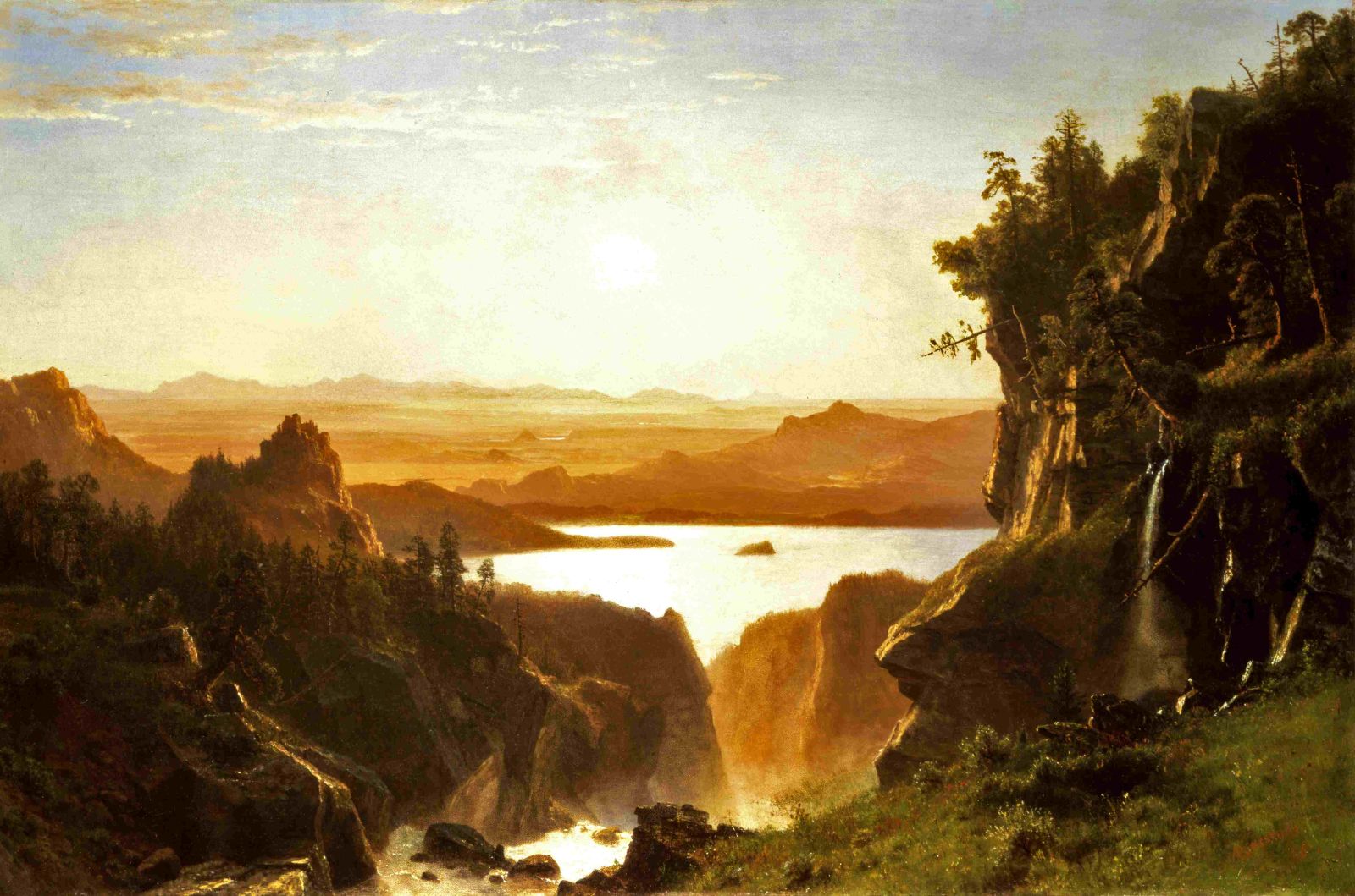
After returning from his 1859 Lander Survey adventure through today’s Wyoming, Albert Bierstadt rented a New York City art studio and began using sketches, photographs, and the artifacts he had collected to develop oil paintings on canvas. My first blog post in this series included one of those paintings: Island Lake (1862).

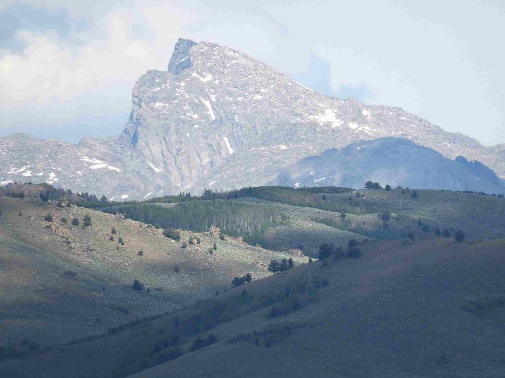
But the feature of our valley that may have interested him most was Temple Peak in the southern Wind River Range.

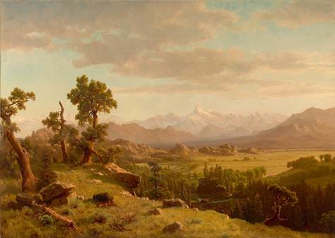
One of Bierstadt’s earliest Far West scenes was this distant view of Temple Peak.

Wind River Country, 1860. Oil on canvas, 29.625 × 43.75 inches. The Charles H. Bayly Collection at the Denver Art Museum, 1987.47.

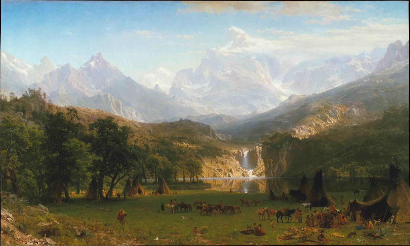
In fact, between 1860 and 1863 – before Bierstadt set off on his next western trek – he created at least three other paintings that clearly featured Temple Peak’s distinctive profile, including the massive canvas that would become his most famous work:

The Rocky Mountains, Lander’s Peak, 1863. Oil on canvas, 73.5 × 120.75 inches. Metropolitan Museum of Art, New York. Image credit: ART RESOURCE, INC.


This ten-foot-wide painting is not only the portrait of a mountain and a waterfall high in the southern Wind River Range; it’s also a portrait of the Shoshone way of life at the time. The foreground is devoted to an Indian encampment, and is based on Bierstadt’s observations of Native people along the Oregon Trail, including those accompanying Chief Washakie when he visited the Survey party in today’s Sublette County.

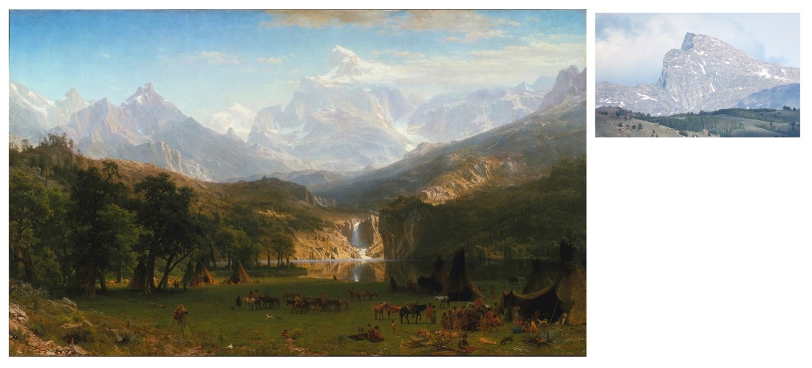
Twenty-first-century locals tend to reject the artwork’s claim to any real place, for several good reasons. To name just a few: the mountain doesn’t look like the one we see from US Highway 191; hikers who’ve approached Temple’s summit don’t recognize the meadow in the foreground or the distant peak; and everyone takes issue with cottonwood trees and a Shoshone village at what appears to be an elevation of 10,500 feet. But Bierstadt’s cloud-mantled summit does bear a resemblance to the peak’s classic silhouette, seen from the northwest:

ART RESOURCE, INC.; Temple Peak photograph by Sue Sommers

As with any mountain, what you see depends on which angle and elevation you’re viewing it from, as well as other conditions like light, season, and weather. The challenge for the traditional landscape painter, however, is translating a vast three-dimensional reality onto a flat plane.

And there was a further challenge for a well-trained Hudson River School painter of the mid-1800s. Bierstadt’s aim was to show Temple Peak to its best advantage, and also capture how if felt to witness the majesty. An art critic at the time complained that Bierstadt and his colleagues, “[compose pictures] from actual sketches … to render the general truths and spirit of the localities of their landscape … so that, though the details of the scenery are substantially correct, the scene as a whole often is false.”[1]

Put more kindly by the curators at today’s Smithsonian Museum of American Art, the goal of the Hudson River School was to “record, with pride and fidelity to nature, the unique, romantic qualities of the American scene” by incorporating plein-aire sketches into “imaginative compositions … to depict the look and feel of America’s wilderness.”[2]

None of that mattered to the American public, who fell in love with the panoramic, virtually cinematic experience of viewing The Rocky Mountains, Landers Peak in person.

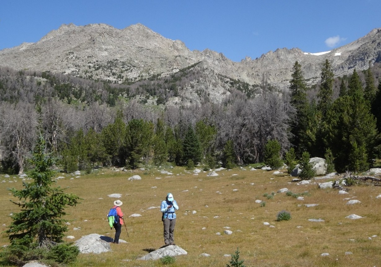
Not surprisingly, when my friends and I hiked to Temple Peak via Sedgewick Meadows about ten years ago, we saw a very different mountain as we approached from the south-southwest:

I asked my friends: “Are you sure we’re on the right mountain?” Photograph by Sue Sommers.

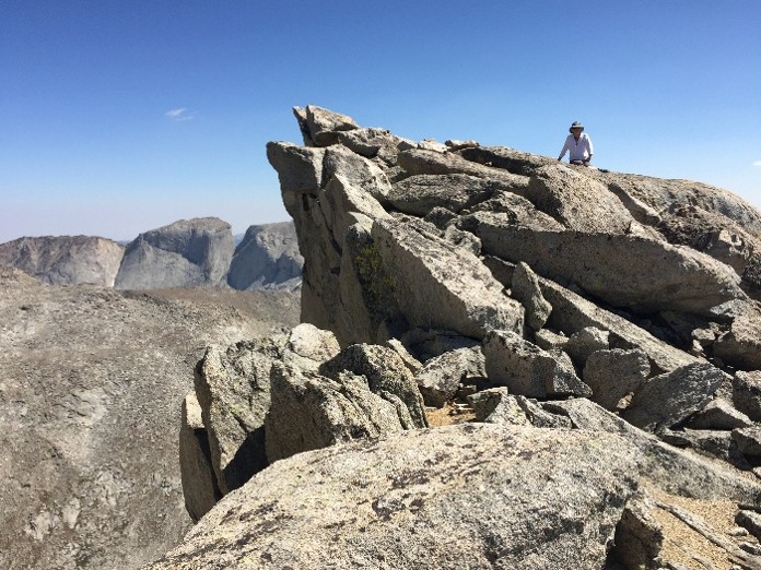
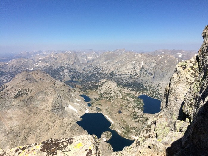
But it turned out that the summit of Temple Peak provides plenty of drama:

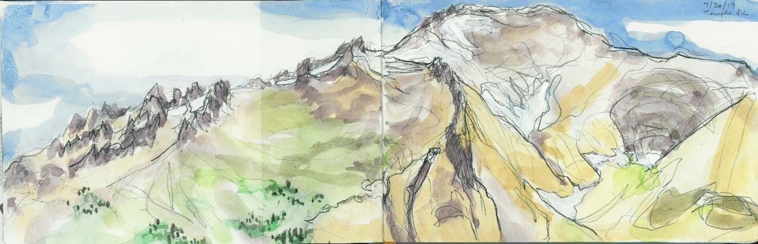
During a later trip to the peak, I visited some high ridges to the south. When the light was right, the summit revealed a different, but fascinating, personality altogether:

Watercolor by Sue Sommers.

Reflections and Questions

Bierstadt debuted his Temple-Peak-inspired masterpiece, The Rocky Mountains, Lander’s Peak, in New York City in 1863, in the midst of the United States’ bloody Civil War. The title of the painting was Bierstadt’s tribute to Colonel Lander, the leader of the expedition to the Far West that Bierstadt had joined in 1859, and who had perished as a Union war hero.

Up to this point, no one had depicted the Rocky Mountains at such a scale, in full color, and in such a breathtaking style.

This painting would launch Bierstadt’s career; it would be exhibited from Albany, New York, to Paris, France, and be displayed before Queen Victoria. In 1865, it would sell for the highest price paid to an American artist up to that time, out-selling all of Bierstadt’s rivals. Engravings and chromolithograph reproductions distributed the image far and wide to the public by subscription.

The Rocky Mountains, Lander’s Peak not only astounded Americans with the majesty and potential of the Far West. It also signaled to other American artists that a new frontier for art was beckoning, and there would be interested buyers.

During my presentation at the Museum of the Mountain Man on August 20, I’ll say more about Albert Bierstadt’s Island Lake and The Rocky Mountains, Lander’s Peak, and why I believe that Bierstadt traveled high in the Wind River Range to collect images for these paintings from actual sites. If Bierstadt “changed the way we view our land, and through our land, ourselves,” then it all started in the Wind River Range.


[1] James Jackson Jarves, quoted in Barbara Novak, American Painting of the Nineteenth Century: Realism, Idealism, and the American Experience (New York: Oxford University Press, 2007), p.60.

[2] https://americanart.si.edu/artist/thomas-cole-943

Explore the Complete Series

Part One: Albert Bierstadt in the Wind River Range: 1859
Part Two: Albert Bierstadt in the Wind River Range: 1859


Interested in learning more about Albert Bierstadt and the Wind River Range? Join us August 20, 2026 at 6 PM for a presentation on Albert Bierstadt and his time in the Wind River Range by Sue Sommers at the Museum of the Mountain Man.

1826 Rocky Mountain Rendezvous

By Rick Williams
July 24, 2026

The 1826 Rocky Mountain Rendezvous marked a turning point in the western fur trade. During this gathering, William H. Ashley began withdrawing from the mountain trade, the partnership of Smith, Jackson & Sublette emerged, and the organizational structure of the Rocky Mountain trapping enterprise underwent significant change. Although contemporary accounts differ on the exact location and duration of the rendezvous, historians generally agree that it occurred in present-day Cache Valley, Utah.

Historical Summary

Location: Willow/Cache Valley (known historically by both names).  Either on Cub Creek (near present-day Cove, Utah, as described in a letter by Daniel Potts to his brother and also the site of John H. Weber’s winter camp of 1824-1825) or on the Blacksmith Fork River (near present-day Hyrum, Utah, as proposed by Dale L. Morgan in The West of William H. Ashley).

Duration: William H. Ashley wrote that he “arrived May 25” and remained on the Bear River until at least July 18. Jedediah Smith, however, suggested they “arrived sometime in June.”  Robert Campbell’s journal indicates a duration of only two weeks, while Daniel Potts’s letter states the celebration of Independence Day (July 4) at the rendezvous.

Significant events

Supplying Expedition from St. Louis

Less than four weeks after the arrival of Ashley and Smith in St. Louis on October 4, 1825 with the furs from the 1825 rendezvous, Ashley’s partner Jedediah Smith set out on October 29 to resupply the men who had remained in the Rockies.  It is interesting to note that he starts out on the route that will become the great Fur Trade Road, also known as the Oregon, Mormon, and California Trail.  He is accompanied by approximately 60 new men, 160 horses and mules and $20,000 worth of supplies.  (See Bicentennial Moments – April 1826)

Wintering in Cache Valley

It appears that Bill Sublette is left in charge of at least a party of men, if not all the men remaining in the mountains.  His party initially wintered near the confluence of Cub Creek and the Bear River (near present day Cove, Utah).  They later moved to the Great Salt Lake Valley near the mouths of the Bear and Weber Rivers (near present day Brigham City and Ogden, Utah).  Whether this move was prompted by a colder winter or diminishing resources such as firewood, buffalo, or cottonwood bark to feed their horses is unknown.

Approximately 200 Snake Indians wintered with the group at the mouth of Bear River and are believed to have joined the men at rendezvous that summer.  

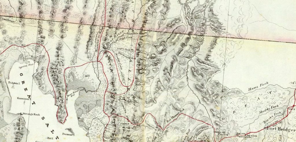
“Map of a Reconnaissance between Fort Leavenworth on the Missouri River, and the Great Salt Lake in the Territory of Utah,” was created in 1852 by Howard Stansbury, with assistance from J.W. Gunnison and Albert Carrington. Map courtesy of David Rumsey Map Collection – Cartography Associates.

Exploration of the Great Salt Lake

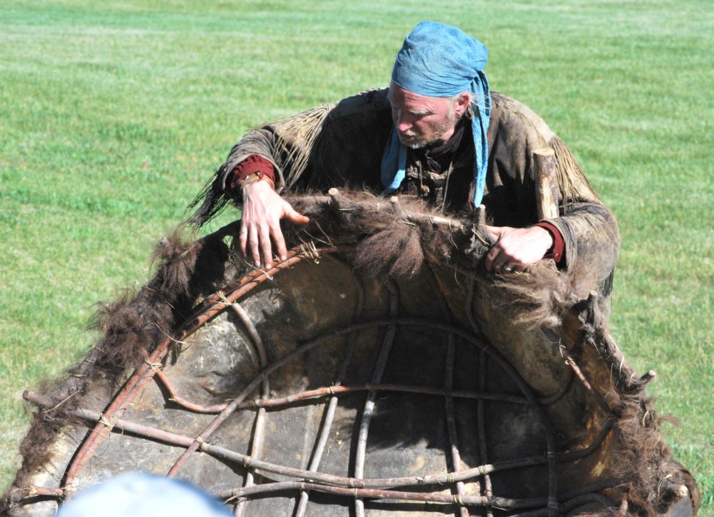
During the following spring, four of the mountaineers constructed bullboats (a boat fashioned of a framework of willow and covered by one or two hides of a bull buffalo – thus the name) they then endeavored to circumnavigate the Great Salt Lake and discover the purported headwaters of the Columbia. This notion had long been held by both British and Americans alike.  Although they did not discover such a place, they speculated on a few places it might exist.  Almost all other great lakes we thought to have one or more inlets as well as an outlet.  A major exception is the Great Salt Lake, which has no outlet.

The 1825-1826 Beaver Hunt

The Fall ‘25 and Spring ‘26 hunts resulted in 123 packs of beaver which Ashley returned upon the pack mules that had brought out the supplies to rendezvous.  The predominant drainages trapped were the Green, Bear, Snake and Weber. It is also probable that Davey Jackson had led a trapping brigade into the Jackson Hole region thus giving it its name and making us aware, for the first time, of his presence and acute leadership in the mountains.

Formation of Smith, Jackson & Sublette

Smith, Jackson and Sublette (SJS) formed their partnership sometime during or shortly after rendezvous to buy out Ashley’s interests in the mountains.  A note was issued to Ashley of $7,821, suggesting that Ashley received approximately $11,000 for his share of the business.  Ashley pays Smith approximately $5,000 for Smith’s portion, leaving Ashley with control of the goods needed to supply the following year’s rendezvous.  The new partnership paid Ashley $3,000 from the proceeds of some of that year’s hunt, with the remaining balance to be from the proceeds of the 1827 season.

Competition Emerges

Upon his return to St. Louis, Ashley attempts to engage B. Pratte and Co. (an alliance of the old French families of Berthold, Pratte and Chouteau of St. Louis) in the creation of a new company. Under this proposed agreement, the company would deliver goods to the 1827 rendezvous, and the men of the supply train would then form a trapping brigade in direct competition to SJ&S. 

However the company of B. Pratte and Co. was negotiating something completely different.  The company instead formed an alliance with John Jacob Astor to create the American Fur Company (AFCo), which would become the competition that Ashley was trying to establish.  In the years that followed, AFCo would become the predominant competition to Ashley’s men, who eventually form the Rocky Mountain Fur Company.

Looking Ahead

Of note, it was from this rendezvous that Jedediah Smith begins his two year odyssey to find new trapping grounds the first year and then rescue his men who remained in California during the second.  It is near the end of the second year that Smith loses most of his men to an Indian attack and returns without furs, thus leaving him dependent upon Jackson and Sublette’s hunts to provide payment on their obligation to Ashley.

Jackson and Sublette each lead their parties to trap that fall and return to winter in Willow/Cache valley the next winter.

Another important result of the 1826 rendezvous was Bill Sublette’s emergence as a leader on the business side of the fur trade. Although still an active trapper, this marked the beginning of a decade in which Sublette would play a central role in shaping the Rocky Mountain Rendezvous into the commercial institution that sustained the fur trade throughout the hear of the heart of the mountains

Although the exact location and duration of the 1826 Rocky Mountain Rendezvous remain subjects of historical debate, its importance is unquestioned. The gathering marked a pivotal transition in the Rocky Mountain fur trade as William H. Ashley began withdrawing from the mountain trade and the partnership of Smith, Jackson & Sublette emerged. At the same time, continued exploration, successful trapping expeditions, and new business alliances shaped the future of the rendezvous system and the western fur trade. The events of 1826 laid the groundwork for the years that followed, making this rendezvous one of the most consequential in Rocky Mountain fur trade history.

Selected References

  • Berry, Don. A Majority of Scoundrels. 1961.
  • Dale, Harrison Clifford, ed. The Explorations of William H. Ashley and Jedediah Smith, 1822–1829. 1941.
  • Gowans, Fred R. Rocky Mountain Rendezvous. 1985.
  • Morgan, Dale L. Jedediah Smith and the Opening of the West. 1953.
  • Morgan, Dale L. The West of William H. Ashley. 1964.

Albert Bierstadt in the Wind River Range: 1859

How Art from Our Mountains Changed America

Part Two

By Sue Sommers
July 20, 2026

How Art from Our Mountains Changed America
Part One Part Two | Part Three

As an artist myself, and someone who has photographed, sketched and painted the Wind River Mountains, I think I understand some of the challenges Albert Bierstadt faced during his summer here in 1859.

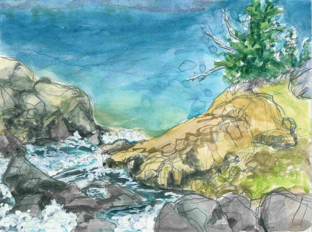
In 2019, I sketched the waterfall dropping into Island Lake from the same viewpoint as my photograph in the previous blog post:

Island Lake Waterfall. Sketch by Sue Sommers.

I wanted to see – and feel – how this location compared to the waterfall in Bierstadt’s painting of Island Lake.

Practically speaking, a multitude of conditions hamper careful, patient artmaking at altitude. There can be low clouds obscuring the views, hordes of biting insects, wind, frightening storms, wildfire smoke fading all colors, and sunlight as harsh and searing as a brass gong, to name just a few. Frustrations may include scattered tools, constantly shifting light, intense physical discomfort, and a lot of wasted paper. I never did make the waterfall appear to drop a great distance into the lake, because I was trying to paint what I saw. As Bierstadt knew well, sometimes you have to paint what isn’t there in order to give the viewer the actual sensations of space and depth.

Just as we share the same challenging conditions Bierstadt likely did while sketching in 1859, we travel into the Winds in much the same way he did: with pack animals and a guide, riding or on foot. Space, weight, and time are at a premium today, just as they were for Bierstadt 167 years ago. Except when he left the mountains, Bierstadt would keep riding and walking all the way to St. Louis, and beyond.

But in my opinion, the biggest challenge for artists among the peaks is scale. Everything up high in the Wind River Range is very close, and unbelievably massive.

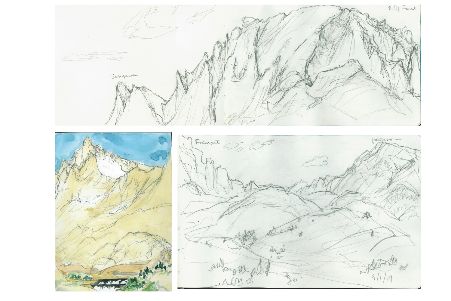
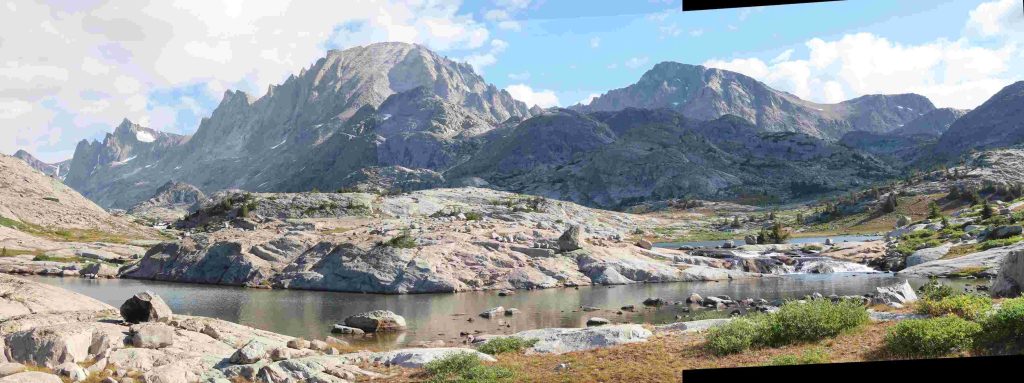
Seven years ago, when I turned away from Island Lake and faced the opposite direction, I saw and photographed part of the spine of the Winds. First, I drew and painted studies of what I saw. I felt the sketches were successful, but my hand and the paper weren’t compatible with the scale of the actual place:

Clockwise from top: Fremont and Sacagawea peaks; Fremont and Jackson peaks; Mount Helen. Sketches by Sue Sommers.

Much later, I was able to make a collage of two photographs to successfully bring the scene together, but this pushed the mountains farther away. Everything got smaller than I felt it to be. Collage by Sue Sommers

In fact, it’s nearly impossible to fit the three-dimensional reality (and our five senses) of the Rocky Mountains into a single painting or photograph. Bierstadt’s awe and amazement is apparent in a lengthy July 10 letter (The Crayon 1859, p.287) in which he describes “the mighty perpendicular cliffs that rise hundreds of feet aloft, all capped with snow … we are among a different class of mountains.” Although Bierstadt wrote that the Rocky Mountains compared with the Swiss Alps he had visited, up to that point on the Oregon Trail, he would have experienced nothing quite like the Wind River Range.

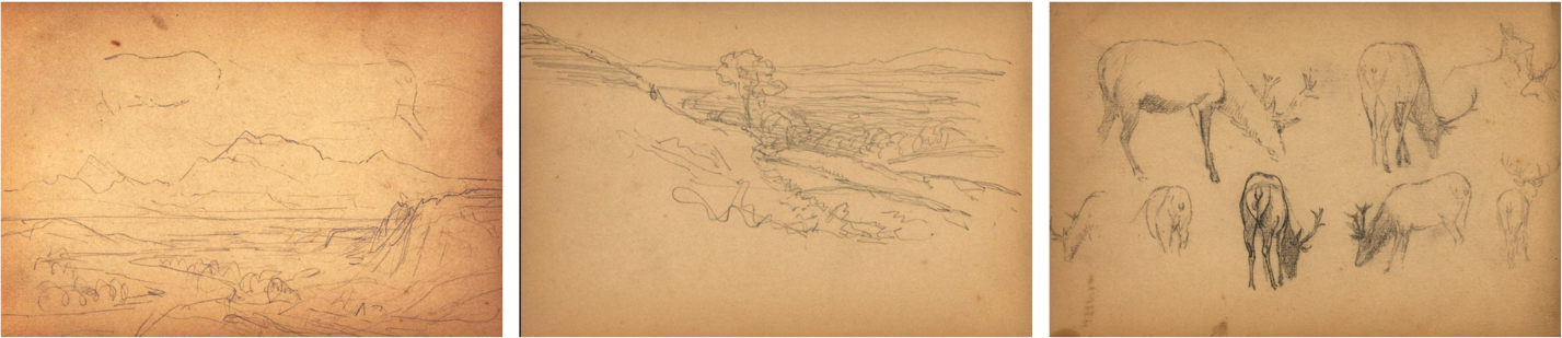
In the same letter, Bierstadt mentioned difficulty with his photographic equipment: “We have taken many stereoscopic views, but not so many of mountain scenery as I could wish, owing to various obstacles attached to the process.” While he succeeded in photographing people, animals, and middle-distance scenes, the Rocky Mountains themselves defied his camera.

This suggests that Bierstadt, like many of us with cameras or brushes, would have relied on the details he captured in smaller scenes to concentrate beauty and spark memory: perhaps sunlight on part of a peak, an animal in a meadow, or wildflowers after a summer storm.

Sketches from an 1859 sketchbook belonging to Bierstadt. Images Courtesy of Special Collections and University Archives, Rutgers University Libraries, New Brunswick, NJ

In the next blog post, we’ll consider Bierstadt’s version of another iconic Wind River peak.

Temple Peak from the Boulder Highway, looking east-southeast. Sublette County, Wyoming. Photo by Sue Sommers

Continue Reading the Series

Part One: Albert Bierstadt in the Wind River Range: 1859
Part Three: Albert Bierstadt in the Wind River Range: 1859


Interested in learning more about Albert Bierstadt and the Wind River Range? Join us August 20, 2026 for a presentation on
Albert Bierstadt and his time in the Wind River Range by Sue Sommers at the Museum of the Mountain Man.
More details coming soon.

Albert Bierstadt in the Wind River Range: 1859

How Art from Our Mountains Changed America

Part One

By Sue Sommers
June 18, 2026

How Art from Our Mountains Changed America
Part One | Part Two | Part Three

If you’ve spent much time in the northern Wind River Mountains of Wyoming, you might have visited Island Lake. The area is very popular with backpackers and climbers, providing access to Titcomb Basin, Fremont Peak, Indian Pass, and countless high elevation lakes.

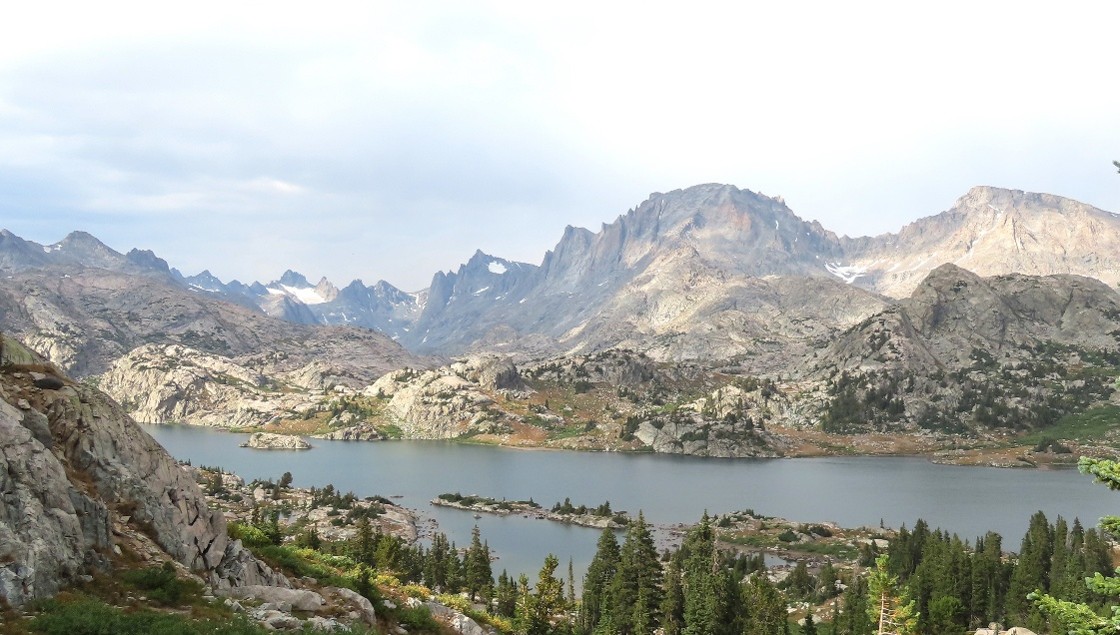
Photo by Sue Sommers

This is the view of Island Lake from the main trail leading from Seneca Lake. On the other side of Island Lake, at the extreme left end of the lake, is the rocky island that gives the lake its name. And nearly hidden by the rocky island is a dramatic waterfall.

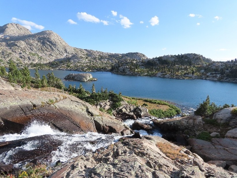
Photo by Sue Sommers

This is the view from the top of the waterfall on the opposite side of the lake, looking back at the trail.

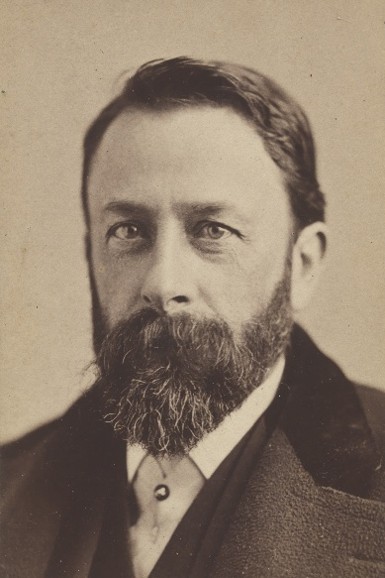
Who was Albert Bierstadt, and what was his connection to the Wind River Mountains?

National Portrait Gallery, Smithsonian Institution

In 1859, German-American painter Albert Bierstadt (1830-1902) had returned from artistic training in Europe and was rising to prominence among the Hudson River School of painters. He decided to join a few other artists tasked with documenting a US Army expedition to the Far West led by Col. Frederick Lander. The purpose of the expedition was to survey and improve the Oregon Trail for the many thousands of people – and their wagons and livestock – heading west. Bierstadt made many sketches and photographs along the trail. His surviving oil and pencil sketches and glass plate negatives capture Native and Euro-American people, encampments, wildlife, and landscapes from the journey.

After he returned to his studio in New York, Bierstadt made this painting of a view high in the Wind River Mountains:

Island Lake, Wind River Range, Wyoming, 1861. Oil on canvas, 27.1875 x 41.25 inches. Buffalo Bill Center of the West. Museum Purchase. 5.79

No one knows for sure how, with whom, or at what point in the expedition Bierstadt might have trekked from the valley floor to this site above 10,000 feet. Some don’t believe that he ever saw Island Lake, and suspect the scene in the painting is a complete invention.

Nor do any of Bierstadt’s existing Lander Survey photographs appear to be from high-elevation sites like Island Lake.  One reason for this could have been the fragile and complex photographic process available to him at that time. By contrast, Bierstadt’s sketching materials, including pencils, paints, and small panels, would have been durable and easy for him to carry or pack on a mule. In any case,  over the months and years that followed, Bierstadt would use his sketches and photographs to help him compose many paintings. Island Lake could have been one of them.

It’s also crucial to keep in mind that artistic conventions during Bierstadt’s time dictated that composition and drama were more important than exact replication.  What similarities and differences do you notice compared to the recent photographs? How do the differences change your experience of the scene?  

Sources and Further Reading

This blog post relies heavily on a landmark article on this subject:

Houston, Jourdan, and Fraser Houston. “The 1859 Lander Expedition Revisited: ‘Worthy Relics’ Tell New Tales of a Wind River Wagon Road.” Montana: The Magazine of Western History 49, no. 2 (Summer 1999): 50–72.

Additional sources consulted include:

  • Anderson, Nancy K., and Linda S. Ferber. Albert Bierstadt: Art & Enterprise. New York: Hudson Hills Press in association with the Brooklyn Museum, 1990.
  • Fischer, Diane P., ed. Primal Visions: Albert Bierstadt “Discovers” America. Montclair, NJ: Montclair Art Museum, 2001.
  • Hassrick, Peter H., et al. Albert Bierstadt: Witness to a Changing West. Norman, OK: University of Oklahoma Press in cooperation with the Buffalo Bill Center of the West, 2018.
  • Hendricks, Gordon. Albert Bierstadt: Painter of the American West. New York: Harry N. Abrams and the Amon Carter Museum of Art, Fort Worth, 1974.
  • Houston, Jourdan Moore, and Alan Fraser Houston. “Henry Hitchings: Educator and ‘Early Devotee of Landscape Art.'” Imprint: Journal of the American Historical Print Collectors Society 26, no. 2 (Autumn 2001).
  • Lindquist-Cock, Elizabeth. “Stereoscopic Photography and the Western Paintings of Albert Bierstadt.” Art Quarterly 33, no. 4 (1970): 363–64, note 55.
  • Novak, Barbara. American Painting of the Nineteenth Century: Realism, Idealism, and the American Experience. Oxford: Oxford University Press, 2007.
  • Novak, Barbara. Nature and Culture: American Landscape Painting, 1825–1875. Oxford: Oxford University Press, 2007.
  • Trenton, Patricia, and Peter H. Hassrick. The Rocky Mountains: A Vision for Artists in the Nineteenth Century. Norman: University of Oklahoma Press, 1983.
  • The Crayon (1859): 26, 161, 287.
  • University of Texas Rio Grande Valley Libraries, “Stereographs.” https://utrgv.libguides.com/earlyphotographs/stereograph
  • University of Texas Rio Grande Valley Libraries, “Glass Plate Photography.” https://utrgv.libguides.com/earlyphotographs/glassplate

Continue Reading the Series
Part Two: Albert Bierstadt in the Wind River Range: 1859
How Art from Our Mountains Changed America

Part Three: Albert Bierstadt in the Wind River Range: 1859
How Art from Our Mountains Changed America


Interested in learning more about Albert Bierstadt and the Wind River Range? Join us August 20, 2026 for a presentation on Albert Bierstadt and his time in the Wind River Range by Sue Sommers at the Museum of the Mountain Man.
More details coming soon.